syracuse snow

All posts tagged syracuse snow

10:00 AM Wednesday – So far a dud here in the Syracuse area but some of the other cities are getting some snow and from the sounds of things the storm isn’t over yet. Here is what the National Weather Service is reporting for yesterday and I believe this doesn’t include the overnight snow which will come out later. Syracuse ended up getting a lot of rain rather than snow. Look for another update as the snow stats come in.

Rochester – 3.6
Binghamton – 3.2
Buffalo – 2.5
Albany – 1.7
Syracuse – 0.7

12:16 am Wednesday 11/27/13 – Just a heads up that I’ll probably just keep updating this post as to what’s going on. So far tonight for the last couple of hours it’s been just rain with a mix of sleet every now and then in the Syracuse area. More to come in the morning 😉

It’s starting to look more and more like the storm they have been talking about is going to actually pan out.  They were thinking several days ago that it may have stayed more toward the coast but it is on more of an inland track now and the chances are that at least a few of the Golden Snowball cities will get a decent amount of snow from this storm.  I’m starting to think that Rochester is going to be the King Snowman for this storm and perhaps so far this season.

OK, does anyone have any estimates for this storm?  Let’s say from the start to finish and we’ll call the finish date Thursday at 11:59 PM just in case some lake effect snow gets drawn into the cities when this pulls out..  The normal prize will be a lot of Notta as in Notta Thing other than a virtual pat on the back for calling it right.  The person closests to the snow total for all of the cities snow added up wins.  My guesstimate is below and you can post yours in the comments section anytime before midnight tonight, Tuesday.

Rochester – 13.5
Syracuse – 9.0
Buffalo – 7.0
Binghamton – 3.5
Albany – 2
TOTAL = 35 inches 🙂

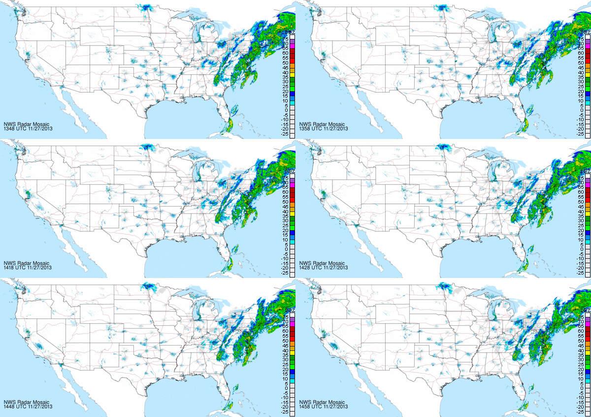
What’s Coming Our Way Courtesy of NOAA

Thanksgiving Storm 11/27 10:15 am

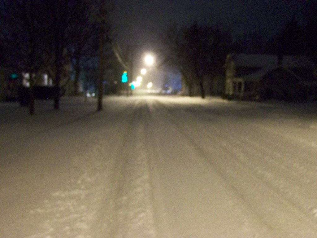
Picture Around 10:00 AM Today, Wednesday

Normally I love a good storm but I really do wish or hope that they don’t happen during the holiday travel times.  Unfortunately this storm most likely will effect quite a few people that will be traveling on Wednesday for the Thanksgiving holiday.  For those of you traveling take it slow and have a safe trip.  I know I’ll be worrying about a few of my family members who will be traveling.  Take it slow and be prepared 😉


Syracuse was the king snowman yesterday so far picking up 4.5 inches of the white fluffy stuff yesterday.  At least I hope it is fluffy and not wet heavy snow because I haven’t shoveled yet.  Syracuse tied the date record of 4.5 inches going back to 1981.  Albany finally got a peak at some snow picking up 0.4 inches.

Like a little kid I get all excited with the first decent snowfall of the season and went for a ride in the middle of a decent snow band that was hitting.  The roads were slick with a few whiteouts from the windy lake effect snow band.  I guess that it what makes LES so cool.  The way the wind really picks up and how much snow can fall in a short amount of time when the snow band sets up over your house 🙂  Of course I say I am like a little kid the first snowfall but I’m really like a little kid every time a storm or good lake effect snow hits.  OK, maybe not so much so come around March when the shoveling starts getting a bit old.

I stayed up until around 2:30 this morning waiting for the new snow totals to come out from NOAA for Buffalo, Rochester and Albany so I would have a nice update this morning for you all buttttt.  When the stats came out for those 3 cities all I saw was MM which means that they were missing the data.  Wasn’t too happy about that of course and I wasn’t staying up until the 5am update, sorry about that.  Then again overall NOAA is awesome with all of the information and stats they collect and post so I’ll stop my whining 😉

The new totals include the snow from yesterday so they will be changing as the snow stats come in today and later tonight.  I should be able to get at least one more update in later and we will see if all of the cities have more to add.  My guess is they will.

A Picture From 11/23/2013 of Snow in Minoa, NY

Minoa, New York Snowfall

Enjoy your Sunday All and Drive Safe!

Syracuse finally got some lake effect snow to help push them to the top of the snow hill.  So far they are showing 2.5 inches of snowfall for the day to put them at the 3 inch mark.  Just enough to take the lead from Binghamton who has been sitting at the top for awhile now.

Snow is still in the forecast so it should be interesting to see what later tonight and tomorrow drops on the Golden Snowball cities.  Will Syracuse be able to hold the lead by the time the Lake Effect Machines start slowing down.  Should be interesting 😉

Then there is the possibility of a storm hitting the East Coast sometime this week.  From what I have been reading the National Weather Service should have some kind of idea toward the end of this weekend as to how that storm will pan out and which cities it may effect.  Makes me wonder if Albany may have an advantage with this one if it happens.  More updates to come as the snow stats come in from NOAA.

Have a Great Night All 🙂

Nothing new to report other than so far we are all having a below average sissy kind of snow season.  Binghamton continues to lead the Golden Snowball contest and Albany continues to trail the rest of the pack.

All of the cities have less snow than normal for this time of the season but all of the cities other than Albany also have more snow than last season at this time so far.  So you ask me what does all of this mean?  I tell you I don’t have a clue what it all means 🙂  I do believe however that it is going to be a cold snowy 2013 – 2014 season or for most of it anyways.  Here is the difference between the normal snowfall for this time of the year and what we all have so far.

Albany – – Minus 0.9 inches

Binghamton – Minus 1.2 inches

Buffalo – Minus 3.3 inches

Rochester – Minus 1.0 inches of snow

Syracuse – Minus 3.3 inches

So in other words for you snow haters out there, enjoy the wimpy 2013 – 2014 snow season that we have had so far.  Father Winter is just taking it easy and planning out what he has in store for us down the snowy road 😉

Have an awesome day all 🙂

Let the games begin!  Syracuse has started the new season with a wimpy 0.2  of an inch of snow but enough to get things started 😉   This is the first measurable snowfall of the season.  Well I was starting to sweat out my last post about the snow season and the Golden Snowball contest starting up.  Thank God NOAA came through with some snow stats, measurable snow stats to start the season up.

Albany is showing MM right now which means they haven’t reported yet or don’t know what to report yet.  I was surprised to see just a trace of snow with the other GSB cities expecting at least Binghamton to report some measurable snowfall.

Then I went into panic mode when Brian Cubbison from the Post Standard posted something about the contest based on my earlier post for the fact when I looked at the stats earlier no snow was being reported yet.  OK, Enough rambling and it is official now 🙂  Let the snow games begin 😉

Have a Super Day All 🙂

I finally woke up this morning to see some of that white fluffy gold in the sky falling and even sticking to the ground a bit. I figured a couple tenths of an inch where I live which is just outside of the city of Syracuse and not too far from the airport where they measure the snowfall for Da’Cuse. It also looked like it was snowing down toward Binghamton’s way so there is a good chance that we may have Liftoff for the new 2013 – 2014 snow season. The question now is which city/cities started it up this season?

How about Rochester or Buffalo? Any snow to report there today? From what I have been reading it’s suppose to be a cold winter this year which could mean some decent Lake Effect Snow for some of us. I’ll post an update later this afternoon or evening when NOAA posts the new stats from earlier today. Remember, ALL of the stats are courtesy of the national weather service and to this day it still amazes me how much info they have on their website.

On one other note there is a rumor going around about a big storm come the end of next week. After reading around about that it seems that right now it’s WAYYYY to far for the pros to predict but if everything falls in place perfectly it is a possibility that it just may pan out. Chances are they won’t be able to pin it down until some time next week so I wouldn’t worry about it just yet or is that I wouldn’t get excited about the Nor’easter just yet 😉

Have an Awesome Day All 😉